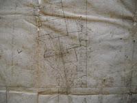
 If "the media is the message," then what is this colonial-era survey map of New Boston, New Hampshire, trying to tell us? The plat appears to be on buckskin, suggesting the surveyor used the media that was closest at hand to plot out the township. It notes a stand of beech trees, a birch tree, and a "heap of stones" as key markers. The raw earthiness of the document, combined with the rigid lines imposed on the irregularly shaped animal skin, shows an overlaying of one culture upon another. The area being mapped was a border between controlled, legislated space, and what the new settlers saw as chaotic wilderness.
In 1736. the General Court of Massachusetts Bay granted New Boston to John Simpson and fifty-two others veterans (or their descendants) of a 1690 expedition to Canada. This map, executed early in the town's history, shows numbered house lots, the mill, and lots dedicated to a school and a minister.
Ask for Manuscript 740940.


No comments :
Post a Comment